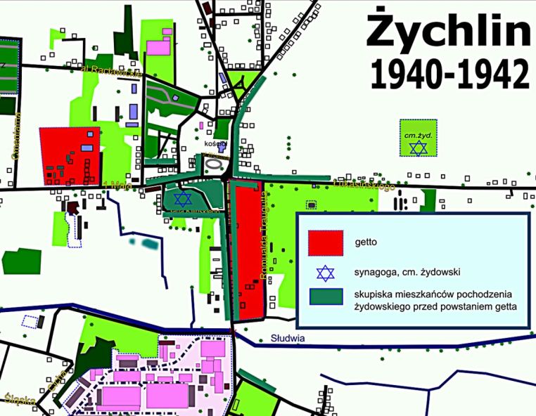
Map of Żychlin 1940-42 showing the ghettos in red, the first one is on the left and the second is on the right. The dark green shows the main areas where Jews lived–note that most were not in what became the ghetto. That meant gentiles had to move out of those areas when the Jews were forced to move in.
